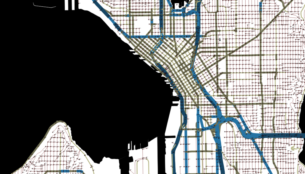
Cities are gathering hubs for commerce and community, with people crisscrossing them for work, errands, entertainment and family. Since the first car/horse interaction, enabling these interlocking, overlapping trajectories to occur safely throughout a city has been a challenge.
In the 21st century, the ongoing consequences of this challenge drove an international response called Vision Zero which hopes to end traffic deaths and serious injuries by 2030.
But the factors that contribute to crashes and dangerous locations are numerous and their interactions complex. Sorting out and weighing the role of factors like excessive speed of vehicles, reduced visibility due to sunlight, or lack of streetlights is complicated. The range of potential interventions is extensive too, including improved design of intersections, expanded enforcement of traffic laws, targeted education campaigns and more. And for deployment decisions, each street corner, crosswalk, bike lane and thoroughfare has its own unique issues.
Inspired by these challenges, DataKind, a nonprofit dedicated to harnessing the power of data science in the service of humanity, and Microsoft partnered with three cities – New York, Seattle and New Orleans – to apply data science to help identify and prioritize opportunities to improve safety. While safety is not a new issue, innovative approaches are needed to bring new ways to combine datasets and expand analytical capabilities to identify complex relationships within civic problems and lay the groundwork to benefit from learnings across cities.
The project began with each municipality sharing a traffic safety challenge specific to their city, which DataKind then used with city-specific data to build and train machine learning models to assess the potential sites and impacts of local interventions.
The overall result was two-fold – each of the cities gained a new understanding and capability around prioritizing their traffic safety initiatives, and DataKind developed fundamental approaches, tools and lessons that could be modified and built on to fit the needs of other cities.
In Seattle, the city focused on bicycle and pedestrian safety issues. The team’s models identified collision patterns and factors that contributed to higher levels of injury severity, including whether a motor vehicle is making a right turn or left turn, the variation in time of the year and the effectiveness of crosswalks in reducing crash severity. They also identified key variables affecting the likelihood of accidents taking place on particular stretches of road, including traffic volume, land use, number of traffic lanes, street width and pedestrian concentration. Seattle recently passed a levy to fund multi-modal transportation improvements citywide. The results from this project, along with additional safety studies, will help guide more than $300 million in Vision Zero investments over the next nine years.
More generally, with the support of volunteers at a Seattle DataDive event, the team jump-started development of a new approach to estimating traffic volume on street segments and further developed and applied this methodology in both New York and Seattle. This new technique can be a resource for future transportation planning beyond safety activities, as the model can also be altered to estimate other defined traffic volume measures, like peak hour traffic volumes. It can also help inform future work related to traffic congestion and citywide vehicle usage.
In New York, with this new exposure model capability, the city can perform initial safety project feasibility studies more efficiently. When combined with crash models, it will help the city test the potential impact different engineering, land use and traffic scenarios would have on total injuries and fatalities.
And in New Orleans, the DataKind team created an Impact Assessment tool that will allow the city to compare various locations that are candidates for street treatments, such as bicycle lanes, and to evaluate the impact of implemented treatments over time.
Details on the data science analyses developed for each city and the resulting impacts are available in the case study here.
In addition to demonstrating how cities can use data science to inform critical investments, this project highlights the opportunities created by innovative new collaborations. For the challenges facing society, such as in safety, health, resilience and education, we need sustained partnerships that bridge sectors, tap expertise across organizations and leverage community-oriented tech solutions.
It also takes forward-thinking city partners who are willing to explore new approaches, redefining what is possible. In their openness to entering new types of collaborations, sharing their issues, allowing DataKind access to their transportation data and using new insights to serve their citizens. New York, Seattle and New Orleans are role models for cities everywhere.
Finally, it takes depth and diverse backgrounds to adequately identify challenges and develop and validate potential solutions. This approach is at the core of this project, and central to DataKind’s organizational model. Learnings from this work, and related projects applying technology to civic priorities, inform and improve how Microsoft is working with partners in government, nonprofits, individuals and the private sector. The lessons we learned in designing solutions for making streets safer can apply to saving energy, reducing urban flooding, increasing access to government services and many other areas.
To learn more about this project, see the press release, the case study, and DataKind’s blog, and connect with Microsoft Civic Technology Engagement.
